

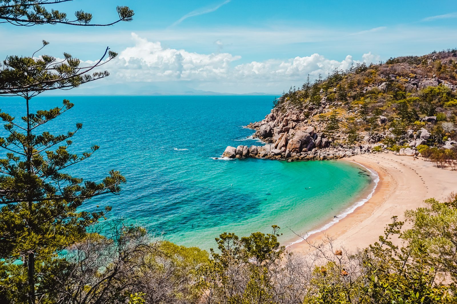
Quick answer
Magnetic Island is publicly accessible year-round with free entry, and navigation resources include printed maps at the Nelly Bay ferry terminal, digital maps from Townsville City Council, and GPS-enabled trail apps. The island divides into four main settlements—Picnic Bay, Nelly Bay, Arcadia, and Horseshoe Bay—connected by Horseshoe Bay Road, while coastal walking tracks and national park trails create alternative routes between beaches and lookout points that don't appear on standard road maps.
The island's geography creates a navigation challenge most visitors underestimate: what appears as a simple coastal drive between bays conceals a network of forty-three marked walking tracks, twelve beach access points, and seventeen lookout positions that reshape how you move through the terrain. A magnetic island tourist map shows more than roads—it reveals the spatial logic of how settlements cluster around protected bays while national park land dominates the interior. Nelly Bay serves as the primary orientation point, where the ferry terminal places you at the island's transport hub. The main road runs north through Arcadia to Horseshoe Bay, covering eleven kilometres, but parallel coastal tracks offer pedestrian routes that cut travel time when traffic slows. Forts Walk, the island's most-used hiking trail, connects multiple lookout points across 2.5 kilometres of headland between bays, and understanding its entry points changes how you sequence beach visits. Printed navigation resources at the ferry terminal include topographic detail for hiking routes, but digital tools offer real-time position tracking that matters when exploring coastal sections where trails split. The Townsville City Council maintains the official digital map layer, updated quarterly to reflect track conditions and seasonal closures. GPS coordinates for trailheads, water stations, and emergency access points appear in the council's downloadable PDF, designed for offline use where mobile coverage drops along the western coastline. The island's road network handles two-way traffic on single-lane sections, making spatial awareness essential during peak periods between 10:00 and 14:00. Bus route 320 follows the main road on a loop schedule, stopping at marked points that don't always align with walking track access. A tourist map clarifies where bus stops, parking areas, and trail entry points intersect, particularly around Geoffrey Bay where reef access paths branch from the main road without clear signage. Reading the island's layout before arrival eliminates the navigation errors that cost visitors half a day retracing routes.
“The island's forty-three marked walking tracks create navigation options that road maps alone don't reveal.”
Magnetic Island Tourist Map: Getting There and Getting Around
Magnetic Island sits just off Townsville in North Queensland, and the only public way across is by passenger ferry into Nelly Bay, the island's main harbor and transport hub.
Townsville (Ross Street terminal) to Nelly Bay ferry terminal
Townsville to Nelly Bay vehicle ferry (for cars)
Sunbus Magnetic Island service, Nelly Bay to Arcadia, Horseshoe Bay and Picnic Bay
Own or hire vehicle via car ferry, island road connects Picnic Bay to Horseshoe Bay
On-call taxi service between bays
Reading the Magnetic Island Tourist Map: Bays and Zones
Magnetic Island's tourist map divides the island into a handful of named bays and settlements, each with its own character. Knowing what each zone is known for makes the map easier to read once you're on the ground.
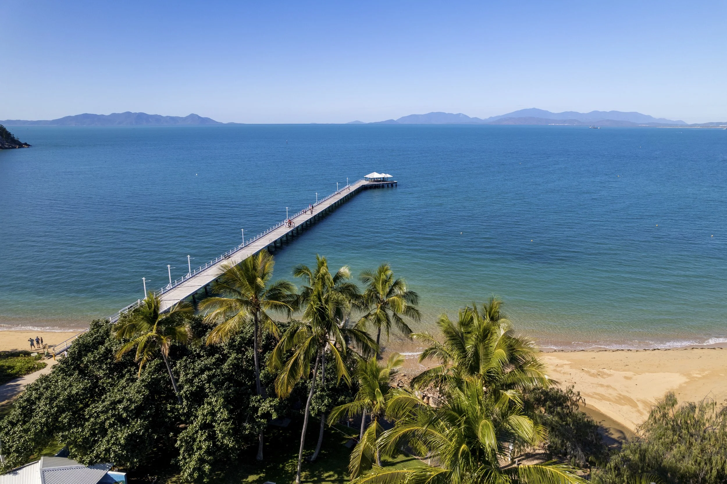
Picnic Bay
The original ferry landing point on the island's south tip, now a quieter settlement with a palm-lined foreshore and small shopping strip.
Walk the foreshore path at low tide for exposed rock pools.
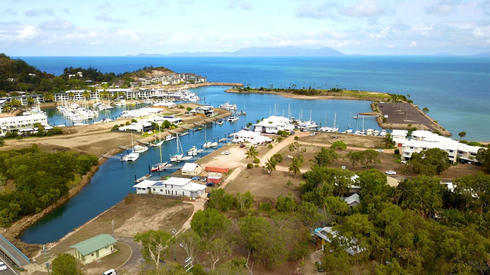
Nelly Bay
The island's main harbour and busiest settlement, home to the ferry terminal, Magnetic Marina, and the widest range of shops and eateries.
Check the marina boardwalk for reef boat departures.
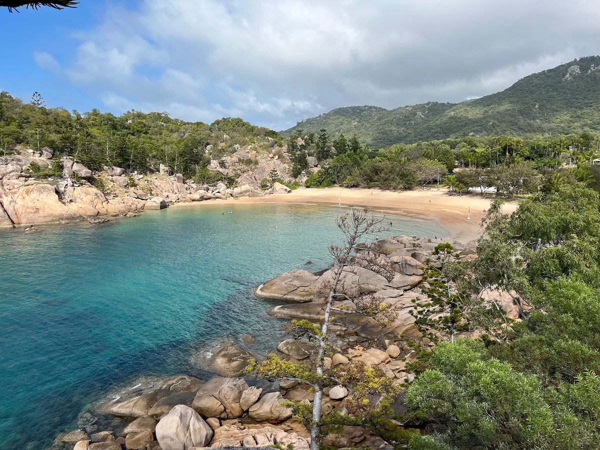
Arcadia
A residential and dining hub roughly midway up the east coast, centred on Alma Bay's small sheltered cove.
Look for rock wallabies near Alma Bay's headland at dusk.
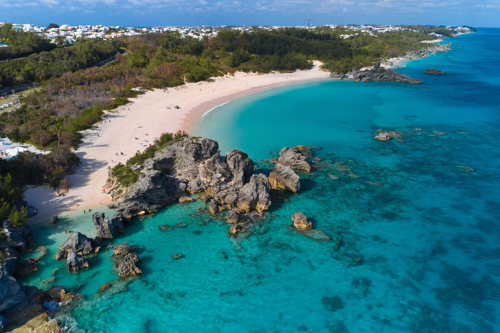
Horseshoe Bay
The largest and northernmost bay accessible by road, known for its long curved beach and watersports.
Walk to the bay's quieter eastern end for fewer crowds.
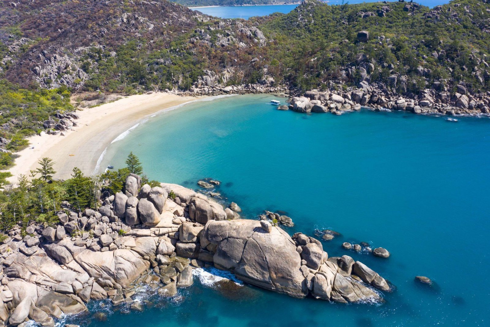
Radical Bay
A secluded, less-developed bay on the island's northeast, reached via walking track rather than road.
Take the coastal track from Horseshoe Bay, not the road.
Planning Your Route with the Magnetic Island Tourist Map
This route suits first-time visitors arriving on the morning ferry and covers the island's key zones over six to seven hours. Use a hired vehicle or the island bus network to move between stops.
Arrive at Nelly Bay terminal
Step off the ferry and collect your hired vehicle or check the bus timetable posted near the jetty. Allow fifteen minutes to organise transport before heading out.
Horseshoe Bay beach circuit
Drive to the northern end and walk the beach perimeter, stopping at cafés if needed. Budget ninety minutes for the bay loop and a swim.
Arcadia Village and Alma Bay
Park near the village centre and walk the short boardwalk to Alma Bay for snorkelling over the fringing reef. This stop takes about an hour including water time.
Picnic Point lookout
Continue west along Horseshoe Bay Road to the signed lookout for views across Cleveland Bay. Five-minute stop, no facilities on site.
Nelly Bay foreshore walk
Return via the coastal path linking Nelly Bay and Arcadia, around two kilometres one way with seating areas. Walk takes forty-five minutes at a steady pace.
Forts Walk trailhead
Start the historic walk from the car park near Horseshoe Bay; the full circuit covers three kilometres and takes ninety minutes including observation-post stops.
Return ferry preparation
Drive back to Nelly Bay terminal, return the hire vehicle if required, and join the departure queue. Ferries run regularly until evening.
Best Time to Use the Magnetic Island Tourist Map for Your Visit
The single best window is 07:30–10:00, when temperatures are still cool and you arrive ahead of the first-ferry crowds that build through midday.
May to October (dry season)
Steady daytime visitor numbersMild, dry, around 23-27°C
Walking tracks are fully open and footing is reliable, making this the more predictable stretch for a full day on the map's trail network.
November to April (wet season)
Fewer visitors on overcast daysHot, humid, sudden downpours
Some inland walking tracks can flood or close after heavy rain, so route options on the map may be more limited than in the dry months.
Early morning (07:30-10:00)
Light, before ferry peakCooler than midday
This is the recommended arrival window, giving cooler conditions for the first stretch of walking before the day's heat sets in.
Midday (weekends and school holidays)
Heaviest crowds at ferry terminals and main beachesHot, little shade on open trails
Later starts mean more foot traffic on popular sections shown on the map and higher heat exposure.
Verdict: Arrive between 07:30 and 10:00 during the May-to-October dry season for the coolest conditions, full track access and the lightest crowds.
Magnetic Island Tourist Map: Opening Hours and Access
Magnetic Island is public land with no gate or closing time, so it is open 24 hours every day of the week.
| Monday | 00:00 – 23:59 | No gate hours |
|---|---|---|
| Tuesday | 00:00 – 23:59 | No gate hours |
| Wednesday | 00:00 – 23:59 | No gate hours |
| Thursday | 00:00 – 23:59 | No gate hours |
| Friday | 00:00 – 23:59 | No gate hours |
| Saturday | 00:00 – 23:59 | No gate hours |
| Sunday | 00:00 – 23:59 | No gate hours |
Before You Go: A Magnetic Island Tourist Map Checklist
A few practical steps will help you navigate the island efficiently and stay comfortable on the trails.
-
Download an offline map before departure — Mobile coverage is patchy across the island's bushland tracks and western bays.
-
Pack 2–3 litres of water per person — Walking tracks between bays offer minimal shade and no water taps.
-
Bring sun protection and a hat — Exposed coastal paths and rocky headlands provide little relief from UV.
-
Carry small-denomination cash — A few beach kiosks and snack vendors don't accept card payments.
-
Wear closed walking shoes with grip — Rocky sections and uneven terrain on inland tracks require ankle support.
-
Check ferry schedules and book return tickets — Services fill quickly on weekends and public holidays.
Check availability
FAQs: Magnetic Island Tourist Map
Everything you need to know about magnetic island tourist map